01 / Plan your walk
Know the climb before you go.
Real distance, grade and elevation. Find a walk that fits your day.
Take a closer lookLook up. Breathe in. / Aus Trails
The outdoors is for everyone. Your trail app should be too.
Free offline maps, 3D terrain and live GPS. Choose a walk that fits your day and get to know the route before you go.
No account needed to browse. No card needed for free features.
481 Australian trails to explore
$0 for offline maps & live GPS
No account needed to browse
Independent. Built for the outdoors.The hardest part is choosing
Start with a short walk, a summit or a coastal outlook. The full route is a click away.
 Easy
EasyA short rainforest escape
Springbrook National Park
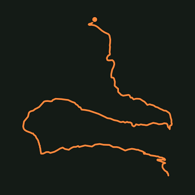 Hard
HardMake a day of the climb
Main Range National Park
 Moderate
A different kind of outlook
Freycinet National Park
 Moderate
Out along the coast
Tasman National Park
How it works out there / Free forever
Free hiking maps, live GPS and practical trail details, from your first plan to your last step.
01 / Plan your walk
Real distance, grade and elevation. Find a walk that fits your day.
Take a closer look02 / Save it before you go
Download your local map area before heading out. Offline maps stay free.
Take a closer look03 / Follow your progress
Enable location to see where you are as you walk, alongside the mapped track.
Take a closer look04 / Notice a wrong turn
Off-route warnings help you notice a deviation and check your surroundings.
Take a closer look05 / Look a little closer
Explore native plant and wildlife guides connected to Australian trails.
Take a closer look06 / Bring your people along
Connect with your hiking buddies once, then share hike-session updates.
Take a closer lookFrom close to home to far away
Find hikes near the Gold Coast, Brisbane and Byron Bay, or explore regional trail guides across Australia.
A real map. A different perspective.
Explore Mount Solitary in the Blue Mountains. Drag, zoom and rotate the live map to see the route in context.
Open this trailOptional extras / Aus Trails Pro
Terrain layers, saved collections and printable maps. Your free safety features stay free.
Pro / Available now
Add terrain shading and a rain radar overlay to your planning map.
Take a closer lookPro / Available now
Organise saved trails into collections for weekends, regions and bigger plans.
Take a closer lookPro / Available now
Print a trail map and elevation sheet to take alongside your digital plan.
Take a closer lookIn development / Not available yet
Multi-trail itineraries and flyover video export are on the roadmap.
Take a closer lookPro: $29.95 every 4 weeks after a 7-day trial. Card required. Cancel anytime. Planned features are labelled.
A little reading. A better plan.
Before you go
Download areas, load a route and understand what still needs reception.
Read the guideGold Coast hinterland
Read the distance, grade, rainforest details and route overview.
Read the guideChoose your walk
Read the elevation profile, grade and time estimate together.
Read the guideFair questions
What is free, what needs a connection, and how the app fits your walk.
Explore the practical guides →Is Aus Trails actually free, or free-until-it-isn't?
Free forever, deliberately. Every safety feature — offline maps, live GPS position, elevation profiles, off-route alerts, buddy notifications — is free with no trial clock. Pro is an optional add-on for planning extras like advanced 3D terrain shading and printable PDF maps, and nothing safety-related will ever move behind it.
Does it work with no phone reception?
Download your map area and open the individual trail while connected, then check the saved view on your device before leaving reception. GPS can work without mobile data, with location permission and a usable fix. Buddy updates, account actions and current weather still need a connection.
How accurate is the trail data?
Routes come from surveyed OpenStreetMap and state government trail data, and distances are computed from the actual route geometry rather than copied from a sign. Live trail-accuracy improvement is on the roadmap: real GPS tracks from hikers who walked the trail, averaged against the mapped route so it gets more precise over time.
Do I need an account?
Not to browse — trail pages, maps and elevation profiles are open. A free account adds hike sessions, comments, photos and buddy connections. Organising saved trails into collections is a Pro feature.
What areas does it cover?
Hundreds of mapped trails across every Australian state and territory, with the deepest coverage in South East Queensland and Northern NSW — the Gold Coast hinterland, Brisbane, the Scenic Rim, Byron Bay and the Border Ranges — and new regions landing regularly.
Can family see where I am on a hike?
With free accounts and buddy connections set up, your people can receive start, finish and off-route updates during a hike session, including your expected return time. Updates require a data connection and appropriate notification permissions; they are not an emergency rescue service.
Built in the open
What you can use today, and what we are working toward.
Shipped / GPS recording
Hike sessions can record the GPS track you actually walked.
Take a closer lookResearching / Not available
We are researching distress relay for low-signal trails.
Take a closer lookLive comments / More stories planned
Trail comments and photos are live. Richer trip stories are planned.
Take a closer lookLook up. Breathe in.
Pick a trail. Get to know the route. Make it your kind of day.
Find a trail — it’s free Explore Gold Coast hikes