Loading map…
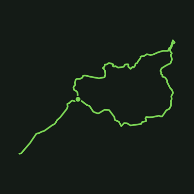
Two walking tracks lead through steep, rocky and uneven bushland to the Cascades swimming area, a quieter alternative to Litchfield's larger waterfalls; the lower track closes when water levels rise and reopens once conditions allow, per the official Cascades page.
Cascades Walk
Litchfield National Park · Batchelor, NT
Distance
2.7 km
Est. time
47 min
Elevation gain
65 m
Elevation loss
60 m
Grade
Easy
Route type
Out & back
Elevation profile
About this trail
Two walking tracks lead through steep, rocky and uneven bushland to the Cascades swimming area, a quieter alternative to Litchfield's larger waterfalls; the lower track closes when water levels rise and reopens once conditions allow, per the official Cascades page.
Source: OpenStreetMap contributors (ODbL) + SRTM 30m via opentopodata.org